



- By Shyam Singh
- 03 Sep 2026
Mumbai’s 27-Km Inner Ring Road to Link Nariman Point With Key Traffic Corridors
New Inner Loop Could Create a Faster Alternative Route Across South Mumbai
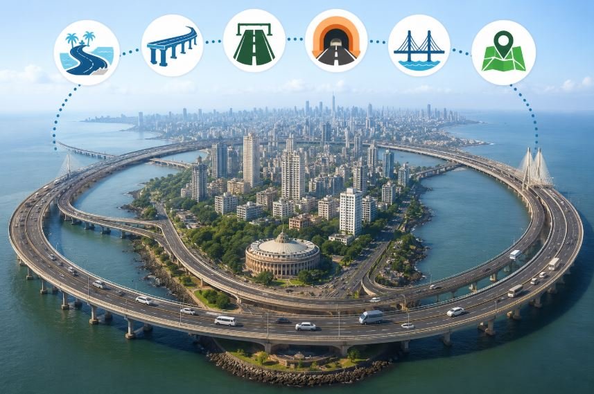
Mumbai is moving toward a new road network designed to improve traffic movement across the city. The first part of the planned system is a 27-km inner ring road centered around Nariman Point.
The proposed loop will connect major infrastructure projects, including the Mumbai Coastal Road, Sewri-Worli Elevated Connector, Eastern Freeway and Orange Gate-Marine Drive connection. Once the remaining links are completed, the route is expected to provide motorists with another option for moving through the city.
27-Km Nariman Point Loop Takes Shape
The 27-km route is the smallest ring in Mumbai’s proposed network. It will start around Nariman Point and connect with the Coastal Road before joining the Sewri-Worli Elevated Connector and Eastern Freeway.
The route will then connect with the Orange Gate-Marine Drive link and move back toward Nariman Point, creating a continuous loop.
Parts of this network are already available to motorists. The Mumbai Coastal Road and Eastern Freeway are operational, while the Sewri-Worli Elevated Connector and Orange Gate-Marine Drive connection are still being developed.
The completion of these projects will be important for making the first ring road fully functional.
Mumbai Plans a Wider Ring Road Network
The Nariman Point loop is only the beginning of a much larger road strategy for Mumbai and the Mumbai Metropolitan Region.
The proposed network includes several larger rings measuring approximately 34 km, 67 km, 98.4 km, 119.62 km, 185.55 km, 197 km, 110 km and 273.5 km.
These larger routes are expected to bring together several major roads, tunnels, sea links and elevated corridors. Key projects include the Bandra-Worli Sea Link, Western Express Highway, Santacruz-Chembur Link Road, Jogeshwari-Vikhroli Link Road, Eastern Freeway Extension, Northern Coastal Road, Dahisar-Bhayandar connection, Uttan-Virar Sea Link and Atal Setu.
New Routes Could Ease Traffic Congestion
The main goal of the ring-road plan is to give drivers more ways to travel across Mumbai and surrounding areas.
At present, traffic often depends heavily on a limited number of north-south routes. When these corridors become crowded, commuters can face longer travel times.
The proposed ring network is designed to create more east-west and orbital connections. This could allow vehicles to avoid heavily congested central stretches and reach different parts of Mumbai through alternative routes.
The network could also improve connectivity between Mumbai’s eastern and western suburbs, Thane, Mira-Bhayandar and developing areas around the harbor.
Major Infrastructure Projects to Work Together
The proposed road system is based on the idea that individual infrastructure projects can become more useful when they are connected.
A sea link, tunnel, elevated road or highway may serve one purpose on its own, but its value can increase when it becomes part of a larger connected route.
For example, motorists could use one corridor and then move onto another major road or link without returning to traditional congested routes. This could make longer journeys across the metropolitan region more convenient.
Missing Links Remain Important
The success of the ring-road system will depend on completing the projects that are currently under construction.
Each missing connection can play a larger role in completing an entire loop. Once the links are joined, existing roads and recently completed projects could become part of a much more connected traffic network.
A single east-west connection could also link two major north-south corridors, giving motorists another travel option while strengthening the larger ring-road system.
Ring Road Strategy Aims to Change Mumbai’s Traffic Pattern
The ring-road concept was outlined by MMRDA Commissioner Dr. Sanjay Mukherjee in 2024 as a broader approach to Mumbai’s road planning.
Instead of developing roads only between individual destinations, the strategy focuses on creating interconnected routes around congested areas. This approach could support smoother movement across different parts of the metropolitan region.
The 27-km Nariman Point loop is therefore expected to serve as the first building block of a much larger network. As more roads, tunnels, sea links and elevated corridors are completed, the proposed rings could provide Mumbai with more travel choices and help improve overall road connectivity.